Precision Tunnel Mapping
NREC pioneered research and development of a low power, small, lightweight system for producing accurate 3D maps of tunnels through its Precision Tunnel Mapping program.
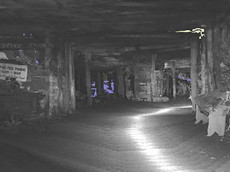
The technology produces accurate maps of challenging zero light environments.
Application
Using robots to explore and investigate tunnels makes sense for miners, warfighters and border security personnel. The immediate application is to generate accurate 3D maps of the tunnel environment.
Accurate 3D maps are essential to key characterization tasks such as identifying tunnel entry and exit points, or calculating the volume of the earth removed in mining applications. Challenges include difficult environmental conditions, small SWaP targets, the need for intuitive 3D driving models for teleoperation and autonomy, and the difficulties of globally registering long underground tunnels from a single entry point.
Capabilities
Our team created a custom sensor and computing pod that produces high quality localization and 3D models of tunnels for live, real-time teleoperation of robotic vehicles in an underground mining operation – the core task required here. Our technology already achieves the target performance metrics in zero light, environmentally challenging conditions without requiring an IMU or GPS.
Our approach combined state-of-the-art visual odometry with lidar scanning to both provide the estimate of vehicle motion and the initial solution for pose optimization. The system runs in real time, on limited computing. 30W powers all sensors, computing, lighting, and actuation. The entire system is small enough to run on a snake robot and is a little larger than a soda can.